Kelixi Fm
Type Locality and Naming
Tieklik region (SW Tarim Basin). The Kelixi Fm was named by Ma Shipeng et al. in 1980 and was published by Gao Xilian in same year. The typical section is situated in Qiakmaklik and Kelixi valleys in Yecheng of Xinjiang Weiwuerzhu Zizhiqu. Middle formation of the Qiakmakelik Gr.
Synonym: (克里西组)
Lithology and Thickness
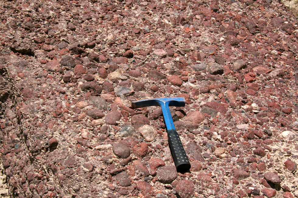
According to the data of the Jianghan Institute of Petroleum, the lower part of the Kelixi Fm is composed of conglomerate debris flows and of purple gray and greenish gray thick-bedded turbidity sandstone, changing upward into a dark gray, greenish gray pelitic chert of a deep-shelf facies. It is thickness of more than 347 m.
[Figure: Lithology of the Kelixi Fm]
Relationships and Distribution
Lower contact
It rests conformably on the underlying Bolong Fm tillite or it unconformably overlaps on the Aqikbaxi Fm of the Sukuluok Gr of Qingbaikouan System if the underlying horizon is absent.
Upper contact
The upper part is disconformably overlain by the tillite of the Yutang Formation.
Regional extent
Tieklik region (SW Tarim Basin). The Kelixi Fm is distributed in Yecheng on the north slope of west Kunlun Mountain to south of Pishan County.
GeoJSON
Fossils
The shale in the lower part yields microplants dominated by Leiopsophosphaera sp., also including Pseudozonosphaera sp., Stictosphaeridium sp., Leiominuscula sp. and Laminarites sp. etc.
Age
Depositional setting
Additional Information
